Latitude: N 50° 37' 50", Longitude: W 1° 59' 23"
Grid Reference : SZ008812
QTH Locator: IO90ap
Trig Point: none (the trig was overturned at the edge of the field)
WAB: SZ08
Nearest Post Code: BH19 3AA
Height: 200m
Elevation/Distance: 150m of ascent over a distance of 1.4km. An easy climb if you stick to the Purbeck Way. Steep and awkward at the start walking across a slope if you follow my route below and come up over Round Down Hill.
Time to ascend: ~20 mins
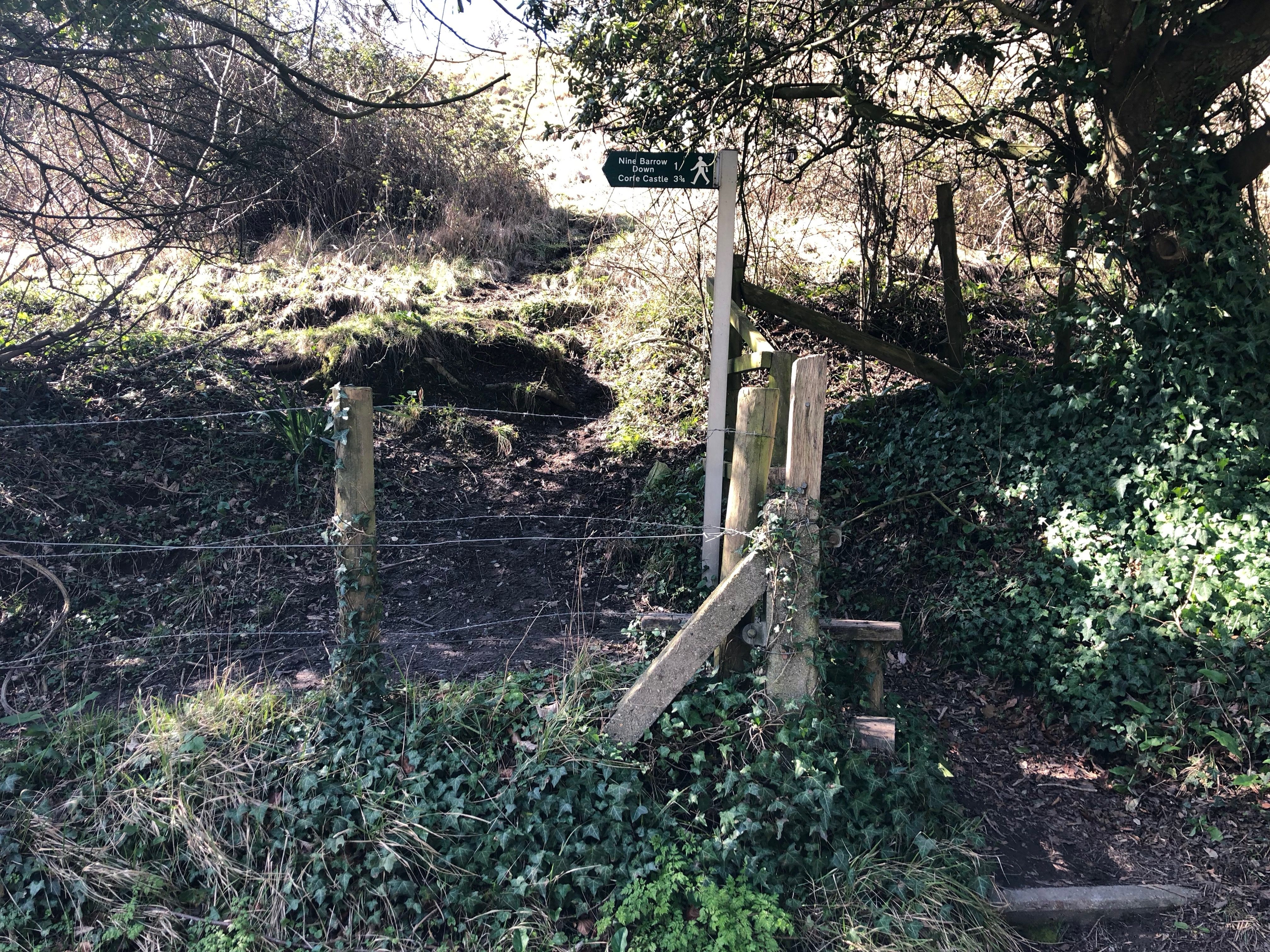
Parking options: I parked at SZ020809 in a huge lay-by and took a steep path over Round Down Hill but note there was a small pull in for 1 or two (at a push) cars at SZ018811 right next to the start of the broad made up road/track (Purbeck Way).
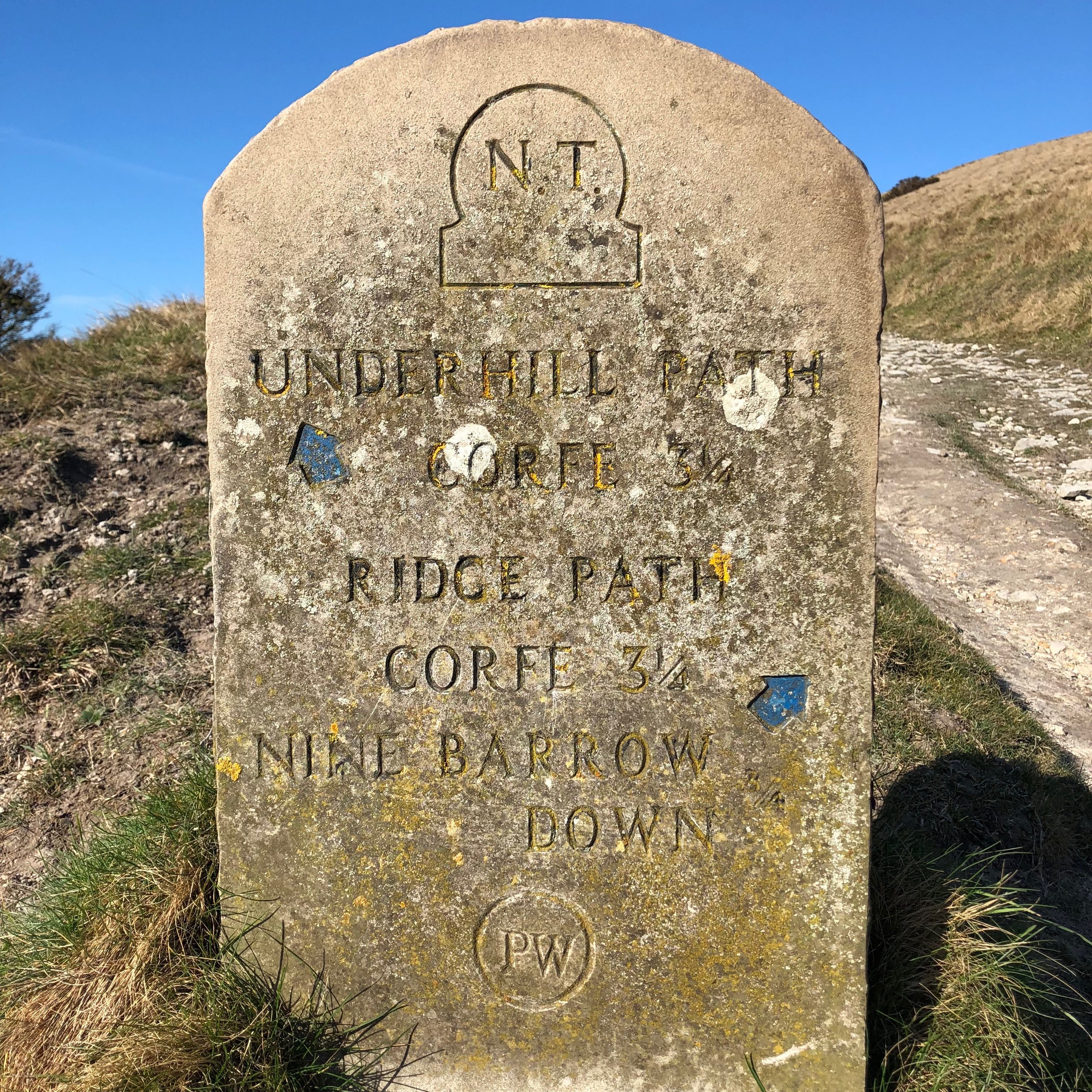
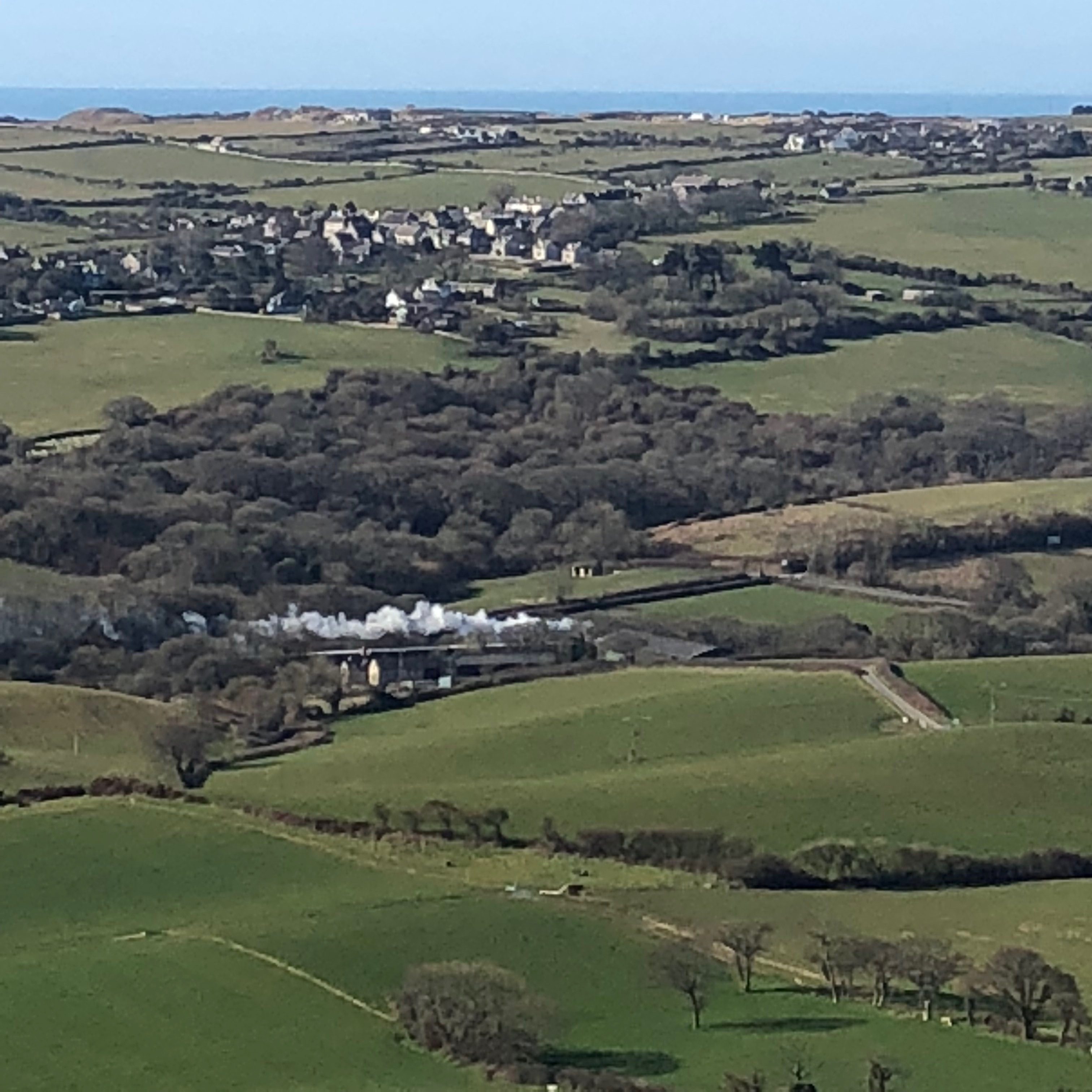
From the large lay-by I used you could walk back up the road to the start of the broad made up track (Purbeck Way) but there is no pavement. Instead I crossed the road from the lay-by where a style gave access to a path straight up the base of Round Down Hill. There are a few attractive diagonal (and not so steep) paths crossing this but ignore then and push straight up. When you level out instead of bearing right and continuing to climb this small hill follow one of the sheep tracks around the hill across the field staying at the same height. This eventually joins the main Purbeck Way where the going is easier on the well made up track/road. Halfway up you'll see a sign post (stone marker) indicating a split in the path...remain on the main 'Ridge Path'. The Purbeck way gives excellent views out over Swanage bay and you're likely to catch a glimpse of the steam engine as it passes up through the valley.
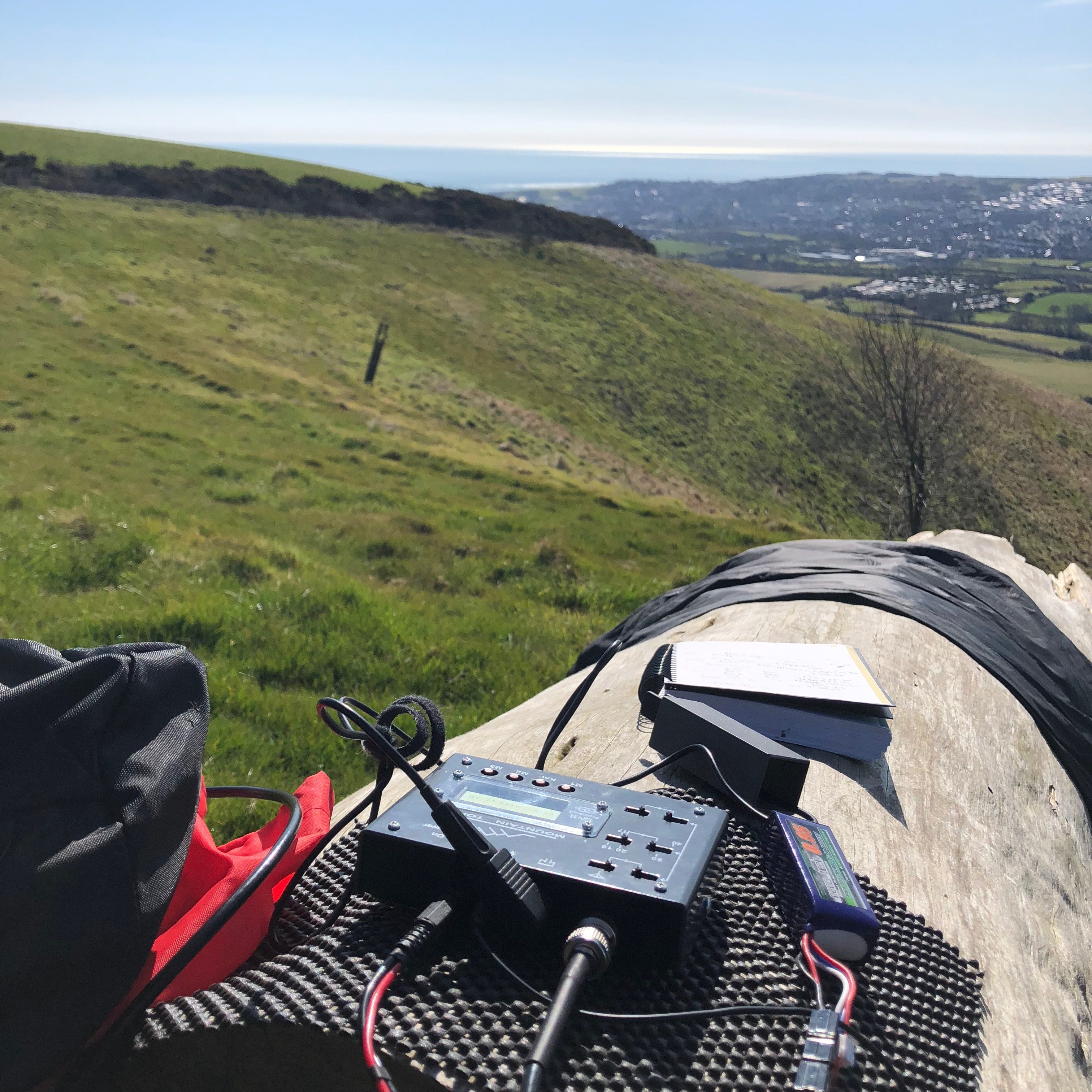
I chose to operate a little off the top of the hill (which looks like a farmers field). The public track is wide and has fence posts so handy to strap a telescopic pole to a post rather than deploy guys. Staying on the main path at the summit would mean a dipole would face north south so I followed the fence off to the left where you will see the remains of the upturned trig point. There are two handy logs to set up on and a fence that gives you an East/West (roughly) take off with a dipole.
Link to SOTAmaps.org for this summit.